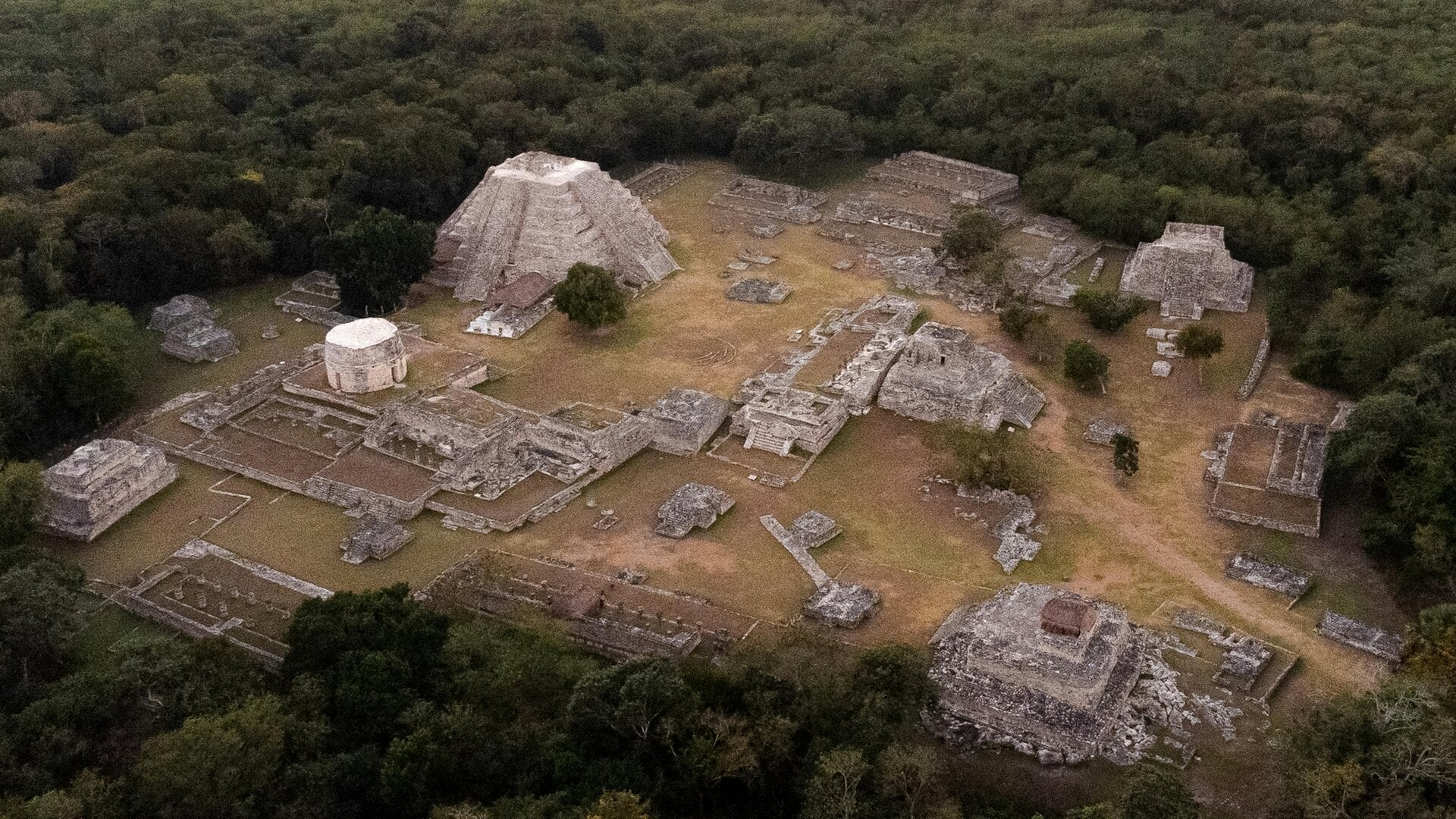
archaeological maps
archaeological maps
  • New Mexico Chaco
  • SW Colorado Chaco
  • The Chaco World
  • About Me
Dittert Site B W Jpg
Image – 1.0 MB 6 downloads
Download

The site consists of an L-shaped masonry building, containing about 30 ground-floor rooms, 8 of which were excavated by Dittert. There may be two stories of construction along the north side. Near the southwest corner is a circular kiva about 6 meters in diameter, which was also excavated by Dittert. The kiva appears to have been partially housed in the roomblock. (Chaco Research Archive)

Dune Ruin B W Jpg
Image – 1.8 MB 5 downloads
Download

Probably the north terminus of the Chaco North road.

Eal Morris B W Jpg
Image – 1.4 MB 6 downloads
Download

The Earl Morris Ruin is a rectangular roomblock located 65 to 70 m north of the East Roomblock of Aztec East. It is roughly 64-by-34 m in size and stands 2.8 m above the modern ground surface. Seven kiva depressions corresponding to Stein and McKenna’s 1989 map (Kivas A-G) were identified during the AERLMP project. (The NPS)

East Ruin B W Jpg
Image – 2.2 MB 6 downloads
Download

East Community is an Ancestral Puebloan great house community and archeological site located 12 miles (19 km) east of Pueblo Bonito, at the eastern end of Chaco Culture National Historical Park, New Mexico, United States. Archeological evidence uncovered during the 1980s suggests the site was occupied by both Chacoans and Mesa Verdeans. Eighty-two structures have been identified in the area, including a great house that contains twenty-five rooms and several small house sites. At least one kiva has been uncovered there, but no great kivas. (Wikepedia)

Edgd Of The Cedars Jpg
Image – 1.2 MB 6 downloads
Download

Several small roomblocks flank either side of the great house. Much of the surrounding community area is coverd by the town of Blanding and adjacent cultivated fields. No block survey has been done. (Chaco Research Archive)

El Faro Jpg
Image – 813.5 KB 5 downloads
Download

The El Faro great house is irregular in form; it has small, rectangular rooms on the east, two kivas in the center, and four large rooms wrapping around the north and west sides of the kivas. The eastern portion of the El Faro great house may have been two stories, but the rest was probably one-story. Tree-ring dates from El Faro indicate that it was built in the early 1100s A.D. (Powers et al. 1983). (The University of Idaho)

El Rito Jpg
Image – 2.1 MB 6 downloads
Download

The El Rito great house is a rectangular mound, two-and possibly three-stories high in portions. It has an estimated 55 rooms, four kivas, and an associated great kiva (Allan and Gauthier 1976). Two of the kivas and the great kiva are located in an open plaza area to the south of the ruin, while two others are present within the roomblock. This great house community is located on the hill slopes and flats around El Rito Creek, southwest of San Mateo and northwest of the summit of Mt. Taylor.  (Chaco Research Archive)

Escavada Community Jpg
Image – 457.9 KB 7 downloads
Download

No data found.

The Escalante Chacoan structure is located on a low gravel hill that directly overlooks the south rim of the Dolores River Canyon west of the Dolores and northeast of Lebanon, Colorado.  Escalante is a roughly squared one-story house of approximately 25 ground-floor rooms and one intramural kiva. The mound rises 2.5–3 m, and the total floor area is estimated at 455 m2. (Chaco Research Archive)

Fajada Butte Jpg
Image – 2.1 MB 5 downloads
Download

Fajada Butte (Banded Butte) rises 135 meters above the canyon floor. Although there is no water source on the butte, there are ruins of small cliff dwellings in the higher regions of the butte. Analysis of fragments of pottery found on Fajada show that these structures were used between the 10th to 13th centuries.[3] The remains of a 95-meter-high, 230-meter-long ramp are evident on the southwestern face of the butte (Ford 1993, p. 478). The magnitude of this building project, without an apparent utilitarian purpose, indicates that Fajada Butte may have had considerable ceremonial importance for the Chacoan people. (Wikepedia)

Farmers B W Jpg
Image – 1.8 MB 6 downloads
Download

Approximately 1.6 km northeast of the Aztec complex and just above tle confluence of the Rio de Los Animas and Farmer Arroyo, the river swings into the northern gravel bench. Here the ascent to the upper surface of the terra: is very precipitous. Located atop the bench are three massive buildings of Bonito style construction, segments of apparent roadways, a great kiva, an isolated large kiva, and three other possible great kivas. (The NPS)

Farview Community Jpg
Image – 2.0 MB 5 downloads
Download

Far View was one of the most densely populated parts of the mesa from A.D. 900 to about A.D. 1300. Nearly 50 villages have been identified within a half square mile area, and were home to hundreds of people. (The NPS)

Flora Vista Jpg
Image – 2.0 MB 7 downloads
Download

No data found.

Kin Cheops Bw Jpg
Image – 2.4 MB 4 downloads
Download

No data found.

Halfway House B W Jpg
Image – 1.4 MB 4 downloads
Download

Halfway House, also known as LA 15191, lies on a slight knoll on the western slope of an unnamed tributary drainage of Gallegos Wash. The site is south-southwest of Huerfano Trading Post and southeast of Carson Trading Post, New Mexico Halfway House is a barely visible rectangular house mound, one story in height, with an estimated 12 rooms. Because aeolian deposits enshroud the mound, its height is difficult to estimate, but a height of about 2 m is probable.  (Chaco Research Archive)

Haystack Great Kiva Jpg
Image – 1.6 MB 7 downloads
Download

Haystack is located in the Red Mesa Valley. Three great houses and five great kivas are found scattered throughout this community. (Chaco Research Archive)

Hogback B W Jpg
Image – 1.2 MB 6 downloads
Download

Haystack is located in the Red Mesa Valley. Three great houses and five great kivas are found scattered throughout this community. (Chaco Research Archive)

Hogback B W Jpg
Image – 1.2 MB 6 downloads
Download

Also known as LA 11594 Component A. This site, located along the Chaco River a mere 11 km south of the San Juan River, consists of an “L”-shaped masonry house with a semicircular enclosed plaza area containing a kiva and three associated midden areas. (Chaco Research Archive)

Hogbback Community Jpg
Image – 2.3 MB 6 downloads
Download

Numerous other unit house complexes occur nearby, comprising the nuclear community of which this site is the center. There is an extensive view reaching to the Chuska and La Plata mountains. (Chaco Research Archive)

Hubbard Tri Wall B W Jpg
Image – 1.1 MB 8 downloads
Download

Hubbard Tri-Wall Site One of a few tri-wall structures in the Southwest, it was built of three concentric walls divided into 22 rooms encircling a kiva. This complex stood atop two earlier structures; one was adobe. Construction may date from the early 1100s. (The NPS)

Hungo Pavi B W Jpg
Image – 1.8 MB 6 downloads
Download

Hungo Pavi is an unexcavated great house located about 1.8 miles (2.9 km.) southeast of Pueblo Bonito at the mouth of Mockingbird Canyon. he site contains approximately 140 rooms.  The north roomblock includes three rows of rooms and stood at least three-stories tall along the rear wall, dropping to a single story along the plaza.   (Chaco Research Archive)

Jaquez B W Jpg
Image – 1.6 MB 6 downloads
Download

No data found. Site is at the mouth of Gallgos Wash.

Village Of The Great Kivas Jpg
Image – 2.4 MB 6 downloads
Download

illage of the Great Kivas is considered a Chacoan Outlier and features two great kivas and two separate room blocks to house around 100 inhabitants. It is also noted for its impressive array of petroglyphs and pictographs and is one of the main archeological sites illustrating the development of Zuni culture. The village was occupied around 1000AD for approximately 50 years and interestingly, also included an additional housing block of a different people from the Gila River region to the south. This site was extensively excavated in in 1930 by Frank H. H. Roberts, Jr.and is listed on the State Register of Cultural Properties and the National Register of Historic Places.  (Four Corners Region Geotourism Stewardship Council)

Kin Hochoi Jpg
Image – 2.7 MB 5 downloads
Download

Kin Hocho’i is in Manuelito Canyon, New Mexico, approximately 130 kilometers southwest of Chaco Canyon. Kin Hocho’i is on the elevated south edge of Lupton Gap and has an expansive view overlooking the gap.

The L-shaped great house defines a plaza on the east side that is enclosed by a curved wall. Surrounding the great house is a sunken avenue 15 meters wide. Around the avenue is an aureola, an encircling earth dike. The aureola is perforated by gateways through which roads enter Kin Hocho’i. At least four kivas are within the roomblock; to the north is an early great kiva and to the northeast is a Chaco era great kiva. (University of Idaho)

Kin Indian Ruin B W Jpg
Image – 1.9 MB 5 downloads
Download

Kin Indian Ruin represents the first Bonito Style outpost to be encountered north of Chaco Canyon. Just as Pueblo Alto rests on the crest of the southern margin of the Escavada Valley so Kin Indian Ruin rests on the crest of the northern margin. A distance of 5km separates the two ruins.  (Chaco Research Archive)

Tsin Kletsin is a small great house located on South Mesa two miles (3.2 km.) south of Pueblo Bonito.  The site consisted of approximately 80 rooms and three kivas (two of which were elevated). (Chaco Research Archive)

Kin Kletso B W Jpg
Image – 2.3 MB 6 downloads
Download

Kin Kletso (Navajo for “yellow house”), is a McElmo-style great house with approximately 65 rooms and 5 kivas.  The kiva at the western end of the building has been identified as a tower kiva.  The ground plan is rectangular and, unlike many earlier great houses, there is no associated great kiva and no plaza.  The pueblo was three stories on the north side, dropping to two stories over the remainder of the building.   Kin Kletso is located roughly 0.5 miles (0.8 km.) northwest of Pueblo Bonito and is accessible at the beginning of the National Park Service Pueblo Alto trail.  Construction has been dated to A.D. 1125-1130 based on a strong cluster of tree-ring dates. (Chaco Research Archive)

Kin Klizhin Jpg
Image – 2.1 MB 4 downloads
Download

Kin Klizhin is a small, unexcavated, great house located roughly 10 miles (16.1 km.) southwest of Pueblo Bonito. Tree rings date the construction of this site to the late A.D. 1080s.  The structure includes 16 rooms, two kivas, a tower kiva, and an enclosed plaza. It has not been excavated.  Due to its high visibility, the three-story tower kiva may have been a signaling station within a broader regional communication system.  The structure can be seen from Tsin Kletsin, a great house just south of Chaco Canyon and a Chacoan road that leaves Chaco Canyon through South Gap. (Chaco Research Archive)

Kin Nahasbas B W Jpg
Image – 1.8 MB 6 downloads
Download

A great kiva and associated roomblock located about 550 feet (168 m.) north-northwest of the Una Vida great house and about three miles (4.8 km) southeast of Pueblo Bonito.  Like Casa Rinconada, the great kiva is elevated above the canyon floor on a sandstone ridge.   (Chaco Research Archive)

Kin Niiyahkeed Jpg
Image – 2.0 MB 6 downloads
Download

Kin Niiyahk’eed has 9 rooms and two kivas in a one-story, 300 m2 area. A short road segment and associated steps ascend a small mesa to provide access to Kin Niiyahk’eed. No great kivas have reportedly been identified in this community. (Chaco Research Archive)

Kin Nizhoni Jpg
Image – 776.6 KB 6 downloads
Download

Kin Niiyahk’eed has 9 rooms and two kivas in a one-story, 300 m2 area. A short road segment and associated steps ascend a small mesa to provide access to Kin Niiyahk’eed. No great kivas have reportedly been identified in this community. (Chaco Research Archive)

Kin Something Jpg
Image – 1.9 MB 6 downloads
Download

Between the residence area and campground. 

29SJ529–on east side of road between Visitors Center and Campground­ “Warnock ‘s ..Little Site..; 20 + rooms, 1-2 kivas, 1 tower; Pl – late PIII.” (“Small Site Architecture of Chaco Canyon”)

Kin Yaa B W Jpg
Image – 1.2 MB 4 downloads
Download

The great house at Kin Ya’a contains 44 rooms and four kivas in four stories, including the tower kiva, from which a burial of an adult male was recovered (Akins 1986:160). With a floor area of 1782m2, this structure is the largest in the study area. A total of 18 tree-ring dates were recovered from the tower and a nearby room; the results indicate an early date of A.D. 1087, a late date of A.D. 1106, and date clusters of A.D. 1087–1088 and A.D. 1106 (Marshall et al. 1979:201–206). However, mean ceramic dating indicates that the structure as a whole was occupied between A.D. 1018-1111. The great kiva is situated 200 m northwest of the great house. (Chaco Research Archive)

Los Rayos Great Kiva Jpg
Image – 2.2 MB 6 downloads
Download

No data found

Lower Greenlee B W Jpg
Image – 1.1 MB 7 downloads
Download

Also known as LA 35419. The apparent construction of this structure upon a platform is not a common aspect of Bonito Style architecture. Presence of the platform-tower kiva combination makes Lower Greenlee a very significant location.  (Chaco Research Archive)

Lower Nizhoni Jpg
Image – 1,007.5 KB 6 downloads
Download

This pueblo is a staggered “L” shaped house containing 3 rooms and an enclosed kiva with a plaza area on the south. Mound elevations of 1.0 to 2.0 m suggest that the entire house was a single story in elevation, but of massive construction. Interior rooms sizes are estimated to be; Room 1, 4 m x 8 m, Room 2, 4 m x 4 m, and Room 3, 3.5 m x 5.5 m. The kiva is 6.0 m in diameter and appears within a rectangular enclosure 9 m x 12 m. The kiva is situated toward the east side of the enclosure, and an additional room may exist to the west (Chaco Research Archive). 

Morris Site 39 Jpg
Image – 2.2 MB 5 downloads
Download

This Chacoan structure and surrounding sites, also known as LA 37601, are located near the confluence of Barker Arroyo and the La Plata River, north-northwest of Farmington and south-southwest of La Plata, New Mexico. (Chaco Research Archive). 

Morris 41 North Jpg
Image – 2.7 MB 6 downloads
Download

A huge site rannging from Bsketmker through PIII, with the biggest great house in the District.  On a bench above the La Plata River.

Morris 41 South Jpg
Image – 2.5 MB 4 downloads
Download
Morris 41 Greathouse Jpg
Image – 2.1 MB 7 downloads
Download

... communities at Morris 39 and 41 also contain multiple great houses. Morris 41 has the largest great house (perhaps 100 rooms) in the La Plata Valley (described by Earl Morris [1939] as the largest sandstone ruin in the valley; Fig- ure 5). As discussed above, the northern great house at Morris 41 is a good can- didate for Chacoan construction in the late 1000s or early 1100s (see Table 3). ...  (MIDDLE SAN JUAN SETTLEMENT PATTERNS: SEARCHING FOR CHACOAN IMMIGRANTS AND EVIDENCE OF LOCAL EMULATION ON THE LANDSCAPE)

Muddy Water Jpg
Image – 1.4 MB 6 downloads
Download

There are three Bonito Phase pueblos and a single great kiva
within the Muddy Water nuclear community area which are
DRAINAGE Indian Creek, to the Chaco Wash, to the recognized as examples of public architecture. The largest pueblo and associated great kiva, LA No. 10959, appear to have served the community throughout the P-ll period. (Chaco Research Archive). 

Naatanii Bikin Jpg
Image – 2.0 MB 6 downloads
Download
New Alto Bw Jpg
Image – 2.1 MB 7 downloads
Download

New Alto is connected to nearby and larger Pueblo Alto by a low masonry wall. New Alto is a small McElmo-style great house similar to Casa Chiquita and Kin Sabe.  In Chaco Canyon, McElmo-phase structures (A.D. 1110-1140) are defined by a square ground plan with an enclosed kiva, multi-story architecture, a new style of pecked stone facings. (Chaco Research Archive). 

Penasco Blanco B W Jpg
Image – 3.0 MB 6 downloads
Download

It is an arch-shaped complex built into the top of a canyon cliff; it was constructed in five different stages between 900 AD and 1125 AD. A painting on a nearby boulder (the "Supernova Plate") may have recorded the observation of a supernova on July 5, 1054 AD


According to the National Park Service, "Pueblo Bonito is the most thoroughly investigated and celebrated cultural site in Chaco Canyon. Planned and constructed in stages between AD 850 to AD 1150 by ancestral Puebloan peoples, this was the center of the Chacoan world."[1] Anthropologist Brian Fagan has said that "Pueblo Bonito is an archeological icon, as famous as England's Stonehenge, Mexico's Teotihuacan, or Peru's Machu Picchu."  (Wikipedia)  Oscar Walsh was a USGLO surveyor working with Neil Judd.

Pueblo Del Arroyo B W Jpg
Image – 1.9 MB 5 downloads
Download

The westernmost great house in Chaco Canyon, Peñasco Blanco sits about 2.7 miles (4.4 km.) northwest of Pueblo Bonito on the northwest tip of West Mesa where it overlooks the confluence of the Chaco and Escavada washes. Peñasco Blanco is the third largest great house in Chaco Canyon and, along with Tsin Kletsin, is one of the only two canyon great houses located on the south side of Chaco Canyon.  The oval ground plan is unlike any other great house and contrasts with the classic D-shape of many other canyon great houses. (Chaco Research Archive). 

Pueblo Pintado B W Jpg
Image – 2.3 MB 6 downloads
Download

1849, the Washington Expedition, a military reconnaissance under the direction of Lt. James Simpson, surveyed Navajo lands. As the party traveled west from Santa Fe, Pueblo Pintado (Spanish for "painted village") was the first Chacoan site they encountered. This Chacoan site was also known as Pueblo de los Ratones, or "village of the mice," Pueblo Colorado or "red village," and Pueblo Grande, or "large village." Its Navajo name is Kin teel, or "wide house." Pueblo Pintado is located 16 miles southeast of Pueblo Bonito and is the easternmost of the Chacoan great houses in the immediate Chaco Canyon area.

The great house is a massive L-shaped building, open to the southeast. The building is terraced, from 3 stories on the outside corner to the single-story enclosed kivas on the interior corner. About 20 single-story rooms enclose the plaza and a large enclosed kiva. The entire great house contained 90 ground-floor rooms, 40 second-story rooms, and 5 third-story rooms. A hundred feet southeast of the building is a subterranean great kiva 58 feet in diameter.  (Aztec NM)

Cuatros Payasos Jpg
Image – 1.0 MB 7 downloads
Download
Shiprock Community Jpg
Image – 1.9 MB 4 downloads
Download

No dats found.

Skunk Springs Community (LA 7000) is situated approximately five miles southwest of Newcomb, New Mexico. It is located on a prominence called Grey Mesa and in the Black House Valley that unfolds to the south. Elevations in the area range from 5,500 ft to 5,900 ft. The great house, known as Black House, and several large villages occupy the southern edge of the mesa, but the remainder of the community extends outward into the valley below. Black House Valley may be characterized as a broad plain that slopes gently to the northeast. Aeolian and alluvial sediments are mixed on this plain, thus providing arable land that is still cultivated today by local Navajo farmers. Run-off from the eastern slopes of the Chuska Mountains is funneled into Tuntsa and Skunk Springs washes, which provide the valley with water.  (Chaco Reserch Archives)

Also known as Morris 40, while the great house is LA 1988. In 1935, Deric Nusbaum representing the Carnegie Institution, conducted a brief reconnaissance of the Squaw Springs nuclear community area. Nusbaum recognized the presence of 43 ruins in proximity to the springs and the importance of the large pueblo central to the complex, which is defined here as the Squaw Springs community center, LA 1988. The form, size, and estimated number of rooms and kivas was defined by Nusbaum for each site; however, the specific locations and temporal affinities were not recognized.

The ruins which represent the Squaw Springs nuclear community complex are clustered in an area approximately 2.0 km NE-SW x 1.0 km NW-SE, situated at the base of a massive slick rock uplift about Navajo, Cottonwood, and Squaw Springs.  (Chaco Research Archives)

Standingrock Jpg
Image – 1.4 MB 4 downloads
Download

The house is a linear “U” shaped structure with a contiguous subrectangular plaza on the south which gives the entire structure a “D” shaped form. The maximum E-W dimension of the house is approximately 30 m and the maximum N-S dimension including the plaza area is 28 m. The long E-W stem and the N-S stem on the east are tier two-rooms wide, while the N-S stem of the west is a single-room wide. “At least the back (north) tier of the house is two stories and portions of the front and sides may also have been of similar height” (Powers et al. 1977). Mound elevations extend to 3.0 m. There is an estimated twenty-four floor rooms within the house and an additional estimated twelve second-story rooms. A maximum of forty rooms is possible. Indistinct outlines of a few walls are visible. Elements consist of tabular sandstone many of which appear shaped. One exposed wall shows sandstone slabs with spall chinking. The walls are core-veneer structures (Powers et al. 1977).  (Chaco Research Archives)

The Accropolis Jpg
Image – 1.9 MB 4 downloads
Download

Called Pierre's  house A, B, & C in the Chaco Research Archives

Three Kiva Jpg
Image – 954.2 KB 4 downloads
Download

Three Kiva is a stabilized pueblo located in Montezuma Canyon along County Road B146 about seven miles upcanyon from the Perkins Road (County Road B206). It features a reconstructed kiva with a roof and ladder access, accessed by a short foot path. The remainder of the pueblo is visible as stabilized wall bases, with the upper parts having collapsed prehistorically. About 1,000 years ago, Three Kiva Ruin was part of a large and thriving community that took advantage of the resources that the canyon had to offer. Extensive excavations by a team of archeologists from Brigham Young University revealed 14 rooms and three kivas, a ramada working area, a trash mound, and a possible turkey run. Large portions of this complex have been stabilized, but only one of the kivas is reconstructed. (The BLM)

Tolokai Jpg
Image – 1.5 MB 4 downloads
Download

The Toh La Kai house is an “L” shaped structure which incorporates a great kiva on the northeast and a rectangular plaza on the northwest. The overall dimensions of the complex are 40 m x 43 m, while the maximum structural dimensions of the house alone are 39 m x 20 m. Wilcox estimates total interior floor area of 800 m2. The house is estimated to contain seventeen ground-floor rooms, a single blocked-in kiva, and an enclosed plaza or court on the east which may contain a subterranean kiva. Given the possibility of multiple stories, up to thirty-one rooms may be contained in the block. The elevation of the rubble mound slopes from north to south and ranges from 1 m to over 3 m. The structure appears to be a multiple terrace, with perhaps three stories on the back or south tier. The house was exposed to the north. This is a very unusual situation since, most Anasazi pueblos are oriented to face south or southeast. The reduction of the mound to rounded contours, without walls standing above the rubble, and the presence of only partially visible wall alignments allow for only tentative room size and location estimates. The nature of the rubble and mound contour in the upper back tier does not suggest the presence of elevated kivas but more likely that of rectangular cells.    (Chaco Research Archives)

Tse Bee Kintsoh Jpg
Image – 2.5 MB 4 downloads
Download

Tse Bee Kintsoh is one of the larger communities located in the Red Mesa Valley. Surveys have identified several clustered groups of habitations associated with three great houses, four great kivas, and two short prehistoric road segments. The three great houses in Tse Bee Kintsoh appear to be contemporaneous.
Our knowledge of this community derives primarily from three investigations: two pipeline surveys conducted in the mid- and late-1970s by the Office of Contract Archaeology at UNM and a more detailed study by the Navajo Nation Cultural Resource Management Program reported in 1985. Ceramics recorded at habitations in the community reveal a lengthy occupation span from A.D. 750–1143, with the earliest ceramic collections coming from pithouses.  (Chaco Research Archives)

+

Tsin Kletsin is a small great house located on South Mesa two miles (3.2 km.) south of Pueblo Bonito.  The site consisted of approximately 80 rooms and three kivas (two of which were elevated).  Architecturally, it is considered a transitional site as it juxtaposes a traditional D-shaped layout with McElmo-style veneer.  The site contained both an arced plaza to the south and a rectangular enclosure to the north.  Construction has been dated to the early 12th century based on the masonry style and tree-ring dates. The site has not been excavated.  (Chaco Research Archives)

Twin Angels is an L-shaped, one-story structure of 17 rooms and two kivas. The mound rises to 2.5 m, with a total floor area of 270 m2 estimated (although Wilcox estimates total interior floor area of 470 m2). An examination of the regular layout of the site suggests the large roomblock may have been constructed during a single planned construction phase. But since data on wall construction sequences have not been reported and no tree-ring dates have been obtained, this is conjectural. Whether the small four-room block to the east was constructed previously, contemporaneously, or subsequently is also unknown.  


Because the site was partially excavated by Morris in 1915, a number of rooms are open, revealing core and veneer masonry of Chacoan style. Rooms have a mean size of 12.5 m2, and standing walls of 1.2-1.5 m in conjunction with substantial debris suggest that the ceilings were probably high. The single excavated kiva has some Chaco-style features (Carlson 1966).

Ceramics associated with the house mound and talus trash below (Carlson 1966; McKenna 1976) clearly indicate Early Pueblo III to Late Pueblo III occupation.  (Chaco Research Archives)

Una Vida B W Jpg
Image – 2.0 MB 4 downloads
Download

Una Vida (Spanish for “one life”) is one of the earliest great houses, along with Pueblo Bonito and Peñasco Blanco, and is the fifth largest found in the canyon with about 160 rooms, including some second-story rooms in the western and northern room blocks.  The site is located in the Fajada Gap area – 3.25 miles (5.2 km.) southeast of Pueblo Bonito and 2.3 miles (3.7 km.) southeast of Hungo Pavi.  Tree-ring dates from the oldest portion of the building indicate that construction was initiated in the mid-800s, about the same time as Pueblo Bonito.  That effort may have been limited to the small roomblock that projects to the east of the main great house.  The next building stage began in the mid-10th century and added the western roomblock within the main great house.  The remaining portions of the pueblo appear to have been added between the mid-11th century and about A.D. 1100.  In the historic period, hogans and a corral were constructed on the mounded ruin.  (Chaco Research Archives)

© 2025 archaeological maps
Powered by Webador